We have drawn various flat maps over the centuries, but they all have the same issue: It is impossible to portray the 3D Earth on a 2D map without compromise.
For instance, many 2D maps, which we used to see in textbooks and on classroom walls, depict Greenland as about the same size as Africa, when in fact Africa is 14 times larger, and contain other distortions, particularly regarding the Pacific Ocean, which looks vaster than it is in reality.
In 2021, astrophysicists produced what we believe to be the most accurate flat map of Earth ever.
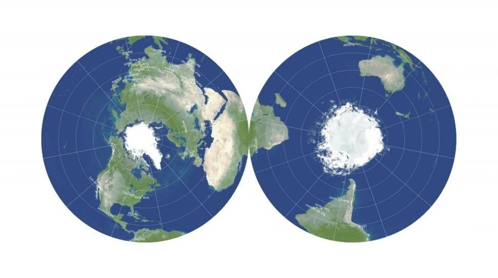
It comprises two “pancake maps” side can view that side or back to back.
Unlike other flat maps, the new circular map doesn’t downsize or supersize the area of certain oceans or landmasses.
This way of presenting the Earth is different to nearly every other flat map, and it remains to be seen if we will widely adopt it for general use.